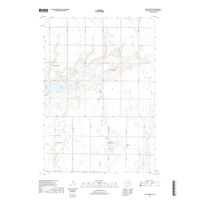
2017 Map of Lake Byron SE
USGS Topo · Published 2017About this map
Lake Byron and its surrounding prairie wetlands define this corner of Beadle County, where the landscape is organized by a precise grid of rural township roads. The eastern shore of the lake is accessed via N Shore Rd, while the broader agricultural territory is punctuated by small community landmarks that reflect the area's social history. Bethel Church and its adjacent Bethel Church Cem stand near the center of the sheet, providing a primary focal point for local genealogical research. Further south, the Liberty Center Cem serves as another key historical marker within the township structure. The drainage of Silver Cr cuts through the northern sections, illustrating the natural water patterns that influenced the placement of farms and cemeteries across this South Dakota plain.
Find a feature on this map
20 named features on this map. Tap any name to fly to it.
Don’t see what you’re looking for? This feature index may not catch every label — zoom into the map to look around manually.
Map Details
Editions of this 2017 Lake Byron SE Map
This is the sole edition of this map. No revisions or reprints were ever made.
Other maps of this area

1895 · Byron
USGS Topo · 1:125,000

1898 · Huron
USGS Topo · 1:125,000

1899 · De Smet
USGS Topo · 1:125,000

1953 · Huron
USGS Topo · 1:250,000

1953 · Watertown
USGS Topo · 1:250,000

1954 · Huron
USGS Topo · 1:250,000

1956 · Lake Byron NW
USGS Topo · 1:24,000

1956 · Lake Byron
USGS Topo · 1:24,000

1956 · Lake Byron SE
USGS Topo · 1:24,000

1958 · Watertown
USGS Topo · 1:250,000