
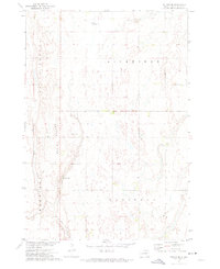
1956 Map of Lake Byron NW
USGS Topo · Published 1957About this map
The prairie landscape of northeastern South Dakota is mapped here as part of a mid-century effort by the Department of the Interior to develop the Missouri River Basin. This survey details the townships of Lincoln, Harrison, Cornwall, Antelope, Pleasant View, and Lake Byron, revealing a rural pattern of isolated schoolhouses and agricultural wells. Foster Creek meanders through the southeastern portion of the quadrangle, serving as a primary drainage for the surrounding terrain.
Find a feature on this map
14 named features on this map. Tap any name to fly to it.
Don’t see what you’re looking for? This feature index may not catch every label — zoom into the map to look around manually.
Map Details
Editions of this 1956 Lake Byron NW Map
This is the sole edition of this map. No revisions or reprints were ever made.
Other maps of this area

1895 · Byron
USGS Topo · 1:125,000

1953 · Huron
USGS Topo · 1:250,000

1954 · Huron
USGS Topo · 1:250,000

1956 · Glendale Colony
USGS Topo · 1:24,000

1956 · Lake Byron
USGS Topo · 1:24,000

1956 · Spink Colony
USGS Topo · 1:24,000

1956 · Doland SW
USGS Topo · 1:24,000

1956 · Lake Byron SE
USGS Topo · 1:24,000

1956 · Hitchcock SE
USGS Topo · 1:24,000
1971 · Doland SE
USGS Topo · 1:24,000
Featured Places
- Cornwall Township, SD
- Harrison Township, SD
- Lincoln Township, SD
- Antelope Township, SD
- Beadle County, SD