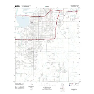
2012 Map of Lake Charles
USGS Topo · Published 2012About this map
The urban and suburban landscape of Lake Charles is centered on its eponymous lake and the winding Calcasieu River. This 2012 survey captures the extensive academic footprint of McNeese State University, including the Cowboy Stadium and Ward Arena. Aviation infrastructure is prominent, with both Chennault International Airport to the east and Lake Charles Regional Airport to the south, separated by the residential expansion of University Place.
Find a feature on this map
45 named features on this map. Tap any name to fly to it.
Don’t see what you’re looking for? This feature index may not catch every label — zoom into the map to look around manually.
Map Details
Editions of this 2012 Lake Charles Map
This is the sole edition of this map. No revisions or reprints were ever made.
Other maps of this area

1932 · Lake Charles NE
USGS Topo · 1:31,680

1932 · Moss Lake
USGS Topo · 1:31,680

1932 · Lake Charles NW
USGS Topo · 1:31,680

1932 · Lake Charles SW
USGS Topo · 1:31,680

1932 · Lake Charles SE
USGS Topo · 1:31,680

1935 · Buhler
USGS Topo · 1:31,680

1935 · Moss Bluff
USGS Topo · 1:31,680

1942 · Lake Charles
USGS Topo · 1:62,500

1946 · Moss Lake
USGS Topo · 1:31,680

1947 · Moss Bluff
USGS Topo · 1:31,680
Featured Places
- Lake Charles, LA
- Westlake, LA
- Hipple, LA
- Greinwich Village, Lake Charles
- Pine Acres Trailer Park, Lake Charles