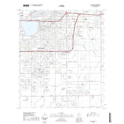
2020 Map of Lake Charles
USGS Topo · Published 2020About this map
Lake Charles dominates this 2020 landscape, revealing a city defined by its relationship with the Calcasieu River and a dense network of civic and educational institutions. The survey highlights the significant presence of regional infrastructure, from the massive footprint of Chennault International Airport to the campus of McNeese State University. For genealogists and local historians, the map is remarkably detailed regarding burial sites, noting locations such as the Old Catholic Cem, Hamilton Memorial Garden Cem, and Sallier Cem.
Find a feature on this map
346 named features on this map. Tap any name to fly to it.
Don’t see what you’re looking for? This feature index may not catch every label — zoom into the map to look around manually.
Map Details
Editions of this 2020 Lake Charles Map
This is the sole edition of this map. No revisions or reprints were ever made.
Other maps of this area

1932 · Lake Charles NE
USGS Topo · 1:31,680

1932 · Moss Lake
USGS Topo · 1:31,680

1932 · Lake Charles NW
USGS Topo · 1:31,680

1932 · Lake Charles SW
USGS Topo · 1:31,680

1932 · Lake Charles SE
USGS Topo · 1:31,680

1935 · Buhler
USGS Topo · 1:31,680

1935 · Moss Bluff
USGS Topo · 1:31,680

1942 · Lake Charles
USGS Topo · 1:62,500

1946 · Moss Lake
USGS Topo · 1:31,680

1947 · Moss Bluff
USGS Topo · 1:31,680
Featured Places
- Lake Charles, LA
- Westlake, LA
- Hipple, LA
- Greinwich Village, Lake Charles
- Pine Acres Trailer Park, Lake Charles