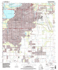
1994 Map of Lake Charles
USGS Topo · Published 1996About this map
Lake Charles sits at a critical junction of water and infrastructure where the Calcasieu River meets the lake's eastern shore. This mid-1990s revision reveals a landscape dominated by transit and aviation, featuring three distinct flight facilities including Chennault Airport and the Lake Charles Regional Airport. The urban grid extends through several named neighborhoods such as Goosport, University Place, and Greinwich Village, while a massive Levee system lines the southern marshes.
Find a feature on this map
31 named features on this map. Tap any name to fly to it.
Don’t see what you’re looking for? This feature index may not catch every label — zoom into the map to look around manually.
Map Details
Editions of this 1994 Lake Charles Map
This is the sole edition of this map. No revisions or reprints were ever made.
Other maps of this area

1932 · Lake Charles NE
USGS Topo · 1:31,680

1932 · Moss Lake
USGS Topo · 1:31,680

1932 · Lake Charles NW
USGS Topo · 1:31,680

1932 · Lake Charles SW
USGS Topo · 1:31,680

1932 · Lake Charles SE
USGS Topo · 1:31,680

1935 · Buhler
USGS Topo · 1:31,680

1935 · Moss Bluff
USGS Topo · 1:31,680

1942 · Lake Charles
USGS Topo · 1:62,500

1946 · Moss Lake
USGS Topo · 1:31,680

1947 · Moss Bluff
USGS Topo · 1:31,680
Featured Places
- Lake Charles, LA
- Westlake, LA
- Pine Acres Trailer Park, Lake Charles
- Hipple, LA
- University Place, Lake Charles