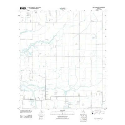
2012 Map of Lake Charles SW
USGS Topo · Published 2012About this map
Prairieland and the surrounding Calcasieu Parish landscape are defined by a complex web of energy infrastructure and water drainage in this 2012 survey. The area south of the Lake Charles Regional Airport is heavily utilized by the petroleum industry, as evidenced by the South Lake Charles Gas Field, South Lake Charles Oil Field, and Big Lake Oil Field. These industrial zones coexist with rural residential developments and agricultural lands partitioned by a grid of local roads like W Lincoln Rd and Tom Stegal Rd. The natural drainage of the low-lying prairie is managed through several winding waterways, including Coulee Hippolyte and the various branches of Black Bayou. For genealogists and local historians, the Hebert Cem serves as a significant landmark of local family heritage amidst the evolving industrial and suburban landscape of southwest Louisiana.
Find a feature on this map
100 named features on this map. Tap any name to fly to it.
Don’t see what you’re looking for? This feature index may not catch every label — zoom into the map to look around manually.
Map Details
Editions of this 2012 Lake Charles SW Map
This is the sole edition of this map. No revisions or reprints were ever made.
Other maps of this area

1932 · Lake Charles NE
USGS Topo · 1:31,680

1932 · Moss Lake
USGS Topo · 1:31,680

1932 · Lake Charles NW
USGS Topo · 1:31,680

1932 · Lake Charles SW
USGS Topo · 1:31,680

1932 · Lake Charles SE
USGS Topo · 1:31,680

1934 · Sweet Lake
USGS Topo · 1:24,000

1934 · Boudreaux Lake
USGS Topo · 1:24,000

1935 · Sweet Lake
USGS Topo · 1:31,680

1935 · Hackberry
USGS Topo · 1:31,680

1935 · Boudreaux Lake
USGS Topo · 1:31,680