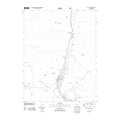
2011 Map of Lake City
USGS Topo · Published 2011About this map
Lake City sits at the confluence of Henson Creek and the Lake Fork, serving as the primary hub in this mountain-ringed valley. The settlement pattern is defined by the steep gulches and narrow valley floors, where the town’s grid is anchored by Silver St and Alpine St. Significant mining history is visible in every direction, with numerous named claims such as the Palmetto Mine, Hoosier Boy Mine, and the Hidden Treasure Mine flanking the watercourses.
Find a feature on this map
81 named features on this map. Tap any name to fly to it.
Don’t see what you’re looking for? This feature index may not catch every label — zoom into the map to look around manually.
Map Details
Editions of this 2011 Lake City Map
This is the sole edition of this map. No revisions or reprints were ever made.
Other maps of this area

1903 · Lake City
USGS Topo · 1:62,500

1905 · Lake City
USGS Topo · 1:62,500

1905 · San Cristobal
USGS Topo · 1:125,000

1907 · San Cristobal
USGS Topo · 1:125,000

1908 · Uncompahgre
USGS Topo · 1:125,000

1911 · Uncompahgre
USGS Topo · 1:125,000

1945 · Durango
USGS Topo · 1:250,000

1953 · Durango
USGS Topo · 1:250,000

1954 · Durango
USGS Topo · 1:250,000

1956 · Montrose
USGS Topo · 1:250,000