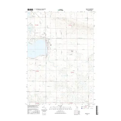
2017 Map of Lake City
USGS Topo · Published 2017About this map
Lake City sits prominently on the eastern shore of Lake Missaukee, serving as the primary hub in this portion of Missaukee County. The map reveals the town's established layout, with the Lake City Cem and Old Lake City Cem positioned to the north, providing clear points of interest for genealogical research. The landscape transition from the village center into the surrounding wetlands is marked by Seafuse Marsh and the headwaters of several streams, including Mosquito Cr and Butterfield Cr. To the east of town, the Home Acres Sky Ranch Airport represents the area's modern infrastructure, while the southern reaches of the quadrangle are defined by the meandering Clam River. This survey documents a region where recreational lake access, small-town settlement, and an intricate network of creeks and marshes converge, illustrating the mid-20th-century development of this Northern Michigan landscape.
Find a feature on this map
76 named features on this map. Tap any name to fly to it.
Don’t see what you’re looking for? This feature index may not catch every label — zoom into the map to look around manually.
Map Details
Editions of this 2017 Lake City Map
This is the sole edition of this map. No revisions or reprints were ever made.
Other maps of this area

1954 · Traverse City
USGS Topo · 1:250,000

1956 · Cadillac North
USGS Topo · 1:62,500

1956 · Lake City
USGS Topo · 1:62,500

1957 · Cadillac South
USGS Topo · 1:62,500

1957 · Marion
USGS Topo · 1:62,500

1958 · Traverse City
USGS Topo · 1:250,000

1983 · Cadillac
USGS Topo · 1:100,000

1983 · Stittsville
USGS Topo · 1:24,000

1983 · Lake City
USGS Topo · 1:25,000
1983 · Dinca
USGS Topo · 1:25,000