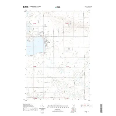
2019 Map of Lake City
USGS Topo · Published 2019About this map
Lake City serves as the focal point of this Missaukee County landscape, established on the eastern shores of Lake Missaukee. As the county seat, the town is anchored by the Missaukee County Courthouse, while its local history is preserved at the Lake City Cem and the Old Lake City Cem nearby. The surrounding terrain is defined by a dense network of waterways and wetlands, including Selfuse Marsh and the wandering paths of Butterfield Cr and Mosquito Cr. To the north, Goose Lake Park and Little Goose Lake offer a glimpse into the region's recreational geography. The southern reaches of the area are drained by the Clam River, while the Home Acres Sky Ranch Airport provides a modern navigational landmark east of the primary settlement.
Find a feature on this map
69 named features on this map. Tap any name to fly to it.
Don’t see what you’re looking for? This feature index may not catch every label — zoom into the map to look around manually.
Map Details
Editions of this 2019 Lake City Map
This is the sole edition of this map. No revisions or reprints were ever made.
Other maps of this area

1954 · Traverse City
USGS Topo · 1:250,000

1956 · Cadillac North
USGS Topo · 1:62,500

1956 · Lake City
USGS Topo · 1:62,500

1957 · Cadillac South
USGS Topo · 1:62,500

1957 · Marion
USGS Topo · 1:62,500

1958 · Traverse City
USGS Topo · 1:250,000

1983 · Cadillac
USGS Topo · 1:100,000

1983 · Stittsville
USGS Topo · 1:24,000

1983 · Lake City
USGS Topo · 1:25,000
1983 · Dinca
USGS Topo · 1:25,000