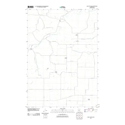
2010 Map of Lake City NW
USGS Topo · Published 2010About this map
Wells Creek and its many tributaries carve through this section of Goodhue County, defining a landscape marked by a dense concentration of religious and family burial grounds. The map reveals the deep roots of German settlement in the region, evidenced by the Old German Evangelical Cemetery, German Lutheran Cemetery, and German Methodist Cemetery. These sites, along with others like the Corfes Private Cemetery and West Florence Cemetery, indicate a well-established rural community organized around parish and family lineage.
Find a feature on this map
47 named features on this map. Tap any name to fly to it.
Don’t see what you’re looking for? This feature index may not catch every label — zoom into the map to look around manually.
Map Details
Editions of this 2010 Lake City NW Map
This is the sole edition of this map. No revisions or reprints were ever made.
Other maps of this area

1940 · Maiden Rock
USGS Topo · 1:62,500

1944 · Red Wing
USGS Topo · 1:62,500

1950 · Maiden Rock
USGS Topo · 1:62,500

1951 · Lake City
USGS Topo · 1:62,500

1952 · Red Wing
USGS Topo · 1:62,500

1953 · Saint Paul
USGS Topo · 1:250,000

1959 · Saint Paul
USGS Topo · 1:250,000

1968 · Goodhue East
USGS Topo · 1:24,000

1968 · Mazeppa
USGS Topo · 1:24,000
1974 · West Albany
USGS Topo · 1:24,000
Featured Places
- Belvidere Township, MN
- Hay Creek Township, MN
- Florence Township, MN
- Goodhue County, MN
- Wabasha County, MN