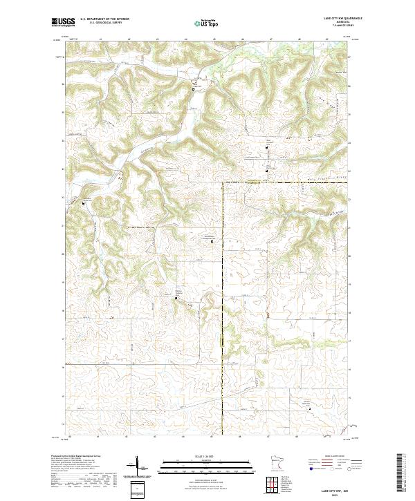
2022 Map of Lake City NW
USGS Topo · Published 2022About this map
West Florence Ridge dominates the southeastern quadrant of this terrain, overlooking a landscape defined by deep valleys and high bluffs in Goodhue County. The intricate drainage of Wells Cr carves through the northern hills, illustrating the erosion patterns typical of this unglaciated region of Minnesota. Notable elevations like Kohn Hill stand as distinct landmarks against the surrounding agricultural plateaus and timbered slopes. The map reveals a dispersed rural settlement pattern, where narrow roads follow the winding valley floors and ridges, connecting family farms across the varied topography of the driftless area.
Find a feature on this map
3 named features on this map. Tap any name to fly to it.
Don’t see what you’re looking for? This feature index may not catch every label — zoom into the map to look around manually.
Map Details
Editions of this 2022 Lake City NW Map
This is the sole edition of this map. No revisions or reprints were ever made.
Other maps of this area

1940 · Maiden Rock
USGS Topo · 1:62,500

1944 · Red Wing
USGS Topo · 1:62,500

1950 · Maiden Rock
USGS Topo · 1:62,500

1951 · Lake City
USGS Topo · 1:62,500

1952 · Red Wing
USGS Topo · 1:62,500

1953 · Saint Paul
USGS Topo · 1:250,000

1959 · Saint Paul
USGS Topo · 1:250,000

1968 · Goodhue East
USGS Topo · 1:24,000

1968 · Mazeppa
USGS Topo · 1:24,000
1974 · West Albany
USGS Topo · 1:24,000
Featured Places
- Belvidere Township, MN
- Florence Township, MN
- Hay Creek Township, MN
- Goodhue County, MN
- Wabasha County, MN