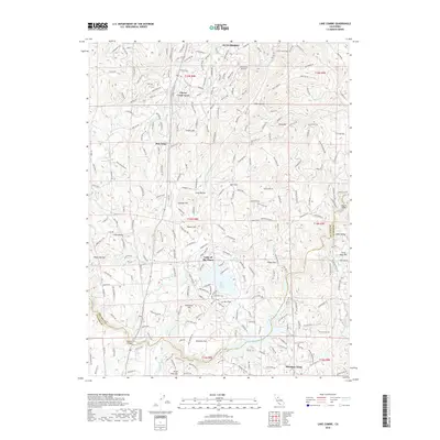
2018 Map of Lake Combie
USGS Topo · Published 2018About this map
Lake Combie and the surrounding Sierra Nevada foothills are defined by a complex network of historic water management systems and mid-century residential growth. This landscape traces the engineering of the Combie Ophir Canal, Bear River Canal, and the Magnolia Ditch, which redirect water through the varied terrain of McCarty Flat and Long Ravine. Settlement patterns reflect a shift from old agricultural and mining areas like Dew Drop and Cottage Hill toward planned communities such as Lake of the Pines and Alta Sierra. Modern infrastructure, including the Alta Sierra Airport and several crossings like the Dog Bar Bridge and Gautier Bridge, connects these hillside enclaves. From the heights of Sugar Pine Mtn down to the banks of the Bear River, the map captures the transition of the Mother Lode region into a residential corridor while preserving the names of local landmarks like Egbert Hill and Fattebert Hill.
Find a feature on this map
243 named features on this map. Tap any name to fly to it.
Don’t see what you’re looking for? This feature index may not catch every label — zoom into the map to look around manually.
Map Details
Editions of this 2018 Lake Combie Map
This is the sole edition of this map. No revisions or reprints were ever made.
Other maps of this area

1888 · Smartsville
USGS Topo · 1:125,000

1891 · Sacramento
USGS Topo · 1:125,000

1891 · Colfax
USGS Topo · 1:125,000

1891 · Smartsville
USGS Topo · 1:125,000

1891 · Placerville
USGS Topo · 1:125,000

1892 · Sacramento
USGS Topo · 1:125,000

1892 · Placerville
USGS Topo · 1:125,000

1892 · Smartsville
USGS Topo · 1:125,000

1892 · Colfax
USGS Topo · 1:125,000

1893 · Placerville
USGS Topo · 1:125,000