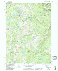
1992 Map of Lake Como
USGS Topo · Published 1995About this map
Lake Como serves as a central point in this part of Wayne County, where the landscape is defined by glacial waters and the industrial footprints of the past. Along the northern edge, an Old Railroad Grade traces a path toward the Delaware River, while scattered quarries near High Lake and Lake Como suggest the region's historical reliance on local stone. The map documents a dense network of summer recreation sites, including Camp Wayne, Camp Winona, and Camp Tioga, which cluster around the numerous ponds and lakes.
Find a feature on this map
52 named features on this map. Tap any name to fly to it.
Don’t see what you’re looking for? This feature index may not catch every label — zoom into the map to look around manually.
Map Details
Editions of this 1992 Lake Como Map
This is the sole edition of this map. No revisions or reprints were ever made.
Other maps of this area

1892 · Honesdale
USGS Topo · 1:62,500

1920 · Long Eddy
USGS Topo · 1:62,500

1920 · Damascus
USGS Topo · 1:62,500

1921 · Long Eddy
USGS Topo · 1:48,000

1923 · Damascus
USGS Topo · 1:62,500

1923 · Long Eddy
USGS Topo · 1:62,500

1924 · Starrucca
USGS Topo · 1:48,000

1926 · Starrucca
USGS Topo · 1:62,500

1930 · Starrucca
USGS Topo · 1:48,000

1933 · Starrucca
USGS Topo · 1:62,500