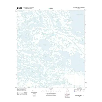
2012 Map of Lake Cuatro Caballo
USGS Topo · Published 2012About this map
Lake Cuatro Caballo sits at the heart of this coastal Louisiana landscape, where the tides of Saint Bernard Parish have sculpted a labyrinth of marshy waterways and shallow basins. This 2012 survey reveals a complex hydrological network defined by the River aux Chenes and the Bay of River Aux Chenes to the south. The absence of traditional roads or terrestrial settlements highlights the isolation of this deltaic region, accessible primarily through the numerous bayous and channels that crisscross the wetlands.
Find a feature on this map
29 named features on this map. Tap any name to fly to it.
Don’t see what you’re looking for? This feature index may not catch every label — zoom into the map to look around manually.
Map Details
Editions of this 2012 Lake Cuatro Caballo Map
This is the sole edition of this map. No revisions or reprints were ever made.
Other maps of this area

1891 · Pointe a La Hache
USGS Topo · 1:62,500

1892 · St. Bernard
USGS Topo · 1:62,500

1892 · Pointe a La Hache
USGS Topo · 1:62,500

1893 · Shell Beach
USGS Topo · 1:62,500

1893 · Dime
USGS Topo · 1:62,500

1935 · Delacroix
USGS Topo · 1:31,680

1935 · Lake Calebasse
USGS Topo · 1:31,680

1935 · Lake Batola
USGS Topo · 1:31,680

1939 · Shell Beach
USGS Topo · 1:62,500

1939 · Pointe a La Hache
USGS Topo · 1:62,500