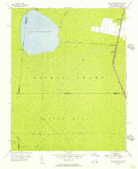
1954 Map of Lake Drummond
USGS Topo · Published 1956About this map
Lake Drummond dominates this mid-century landscape, surrounded by the dense marshlands of the Dismal Swamp at the border of Virginia and North Carolina. The map illustrates a complex network of man-made hydrology designed to navigate and drain this unique environment, including the Jericho Ditch, Portsmouth Ditch, and the prominent Feeder Ditch which connects the central lake to the eastern transit corridors. Along the eastern edge, the Intracoastal Waterway follows the route of the Dismal Swamp Canal, a vital artery for regional commerce and travel.
Find a feature on this map
29 named features on this map. Tap any name to fly to it.
Don’t see what you’re looking for? This feature index may not catch every label — zoom into the map to look around manually.
Map Details
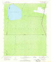
Editions of this 1954 Lake Drummond Map
2 editions found
Other maps of this area

1906 · Beckford
USGS Topo · 1:48,000

1907 · Beckford
USGS Topo · 1:62,500

1919 · Suffolk
USGS Topo · 1:62,500

1940 · Beckford
USGS Topo · 1:62,500

1940 · Lake Drummond
USGS Topo · 1:62,500

1940 · South Mills
USGS Topo · 1:62,500

1945 · Lake Drummond
USGS Topo · 1:62,500

1952 · South Mills
USGS Topo · 1:62,500

1953 · Norfolk
USGS Topo · 1:250,000

1954 · Corapeake
USGS Topo · 1:24,000