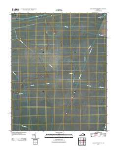
2011 Map of Lake Drummond NW
USGS Topo · Published 2011About this map
Washington Ditch and Jericho Ditch define the strictly geometric landscape of this region in the early twenty-first century, illustrating a centuries-old tradition of hydrological engineering. The map reveals an intricate network of drainage and transport routes, most notably the Dismal Swamp Canal along the eastern edge, which has historically served as a vital maritime artery. This interior topography is marked by a grid of artificial waterways including Hudnell Ditch, Camp Ditch, and Middle Ditch, reflecting a landscape managed for drainage and access. The orientation of features like Hardwood Leg and Portsmouth Ditch provides a clear view of how the land has been partitioned and utilized, while the lone Kentucky Trl represents the limited terrestrial infrastructure within this water-dominated environment.
Find a feature on this map
15 named features on this map. Tap any name to fly to it.
Don’t see what you’re looking for? This feature index may not catch every label — zoom into the map to look around manually.
Map Details
Editions of this 2011 Lake Drummond NW Map
This is the sole edition of this map. No revisions or reprints were ever made.
Other maps of this area

1907 · Norfolk
USGS Topo · 1:125,000

1919 · Smithfield
USGS Topo · 1:62,500

1919 · Suffolk
USGS Topo · 1:62,500

1921 · Newport News
USGS Topo · 1:62,500

1940 · Lake Drummond
USGS Topo · 1:62,500

1944 · Norfolk South
USGS Topo · 1:25,000

1945 · Lake Drummond
USGS Topo · 1:62,500

1948 · Norfolk South
USGS Topo · 1:24,000

1949 · Chuckatuck
USGS Topo · 1:24,000
1952 · Bowers Hill
USGS Topo · 1:24,000