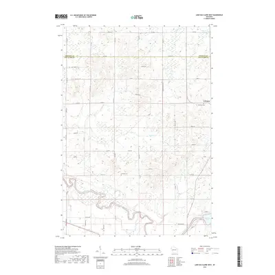
2018 Map of Lake Eau Claire West
USGS Topo · Published 2018About this map
Ludington serves as the primary focal point of this rural Wisconsin landscape, situated where the rolling highlands of the Chippewa Co Eau Claire Co border descend toward the southern river valleys. The topography is defined by the winding course of the Eau Claire River and its numerous tributaries, including Beaver Cr and Bears Grass Cr, which carve through the terrain. Evidence of early settlement and community history is preserved in the locations of Bethlehem Cem and Ludington Cem, providing valuable touchpoints for genealogists and local historians. The area's development is marked by a grid of county highways and local routes like Saint Bridget Dr and Oak Knoll Dr, which follow the natural contours of the land around local drainages like Pine Cr and Wildcat Cr.
Find a feature on this map
34 named features on this map. Tap any name to fly to it.
Don’t see what you’re looking for? This feature index may not catch every label — zoom into the map to look around manually.
Map Details
Editions of this 2018 Lake Eau Claire West Map
This is the sole edition of this map. No revisions or reprints were ever made.
Other maps of this area

1927 · Strum
USGS Topo · 1:62,500

1930 · Strum
USGS Topo · 1:62,500

1934 · Chippewa Falls
USGS Topo · 1:62,500

1935 · Osseo
USGS Topo · 1:48,000

1936 · Chippewa Falls
USGS Topo · 1:62,500

1940 · Osseo
USGS Topo · 1:62,500

1952 · Cadott
USGS Topo · 1:62,500

1953 · Eau Claire
USGS Topo · 1:250,000

1958 · Eau Claire
USGS Topo · 1:250,000

1964 · Eau Claire
USGS Topo · 1:250,000