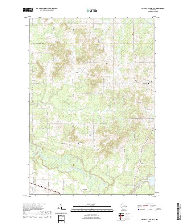
2022 Map of Lake Eau Claire West
USGS Topo · Published 2022About this map
The Eau Claire River and its East Fork define this Wisconsin landscape along the border of Chippewa and Eau Claire counties. In the northern reaches of the map, the small settlement of Ludington is situated near the Bethlehem Cemetery and Ludington Cemetery, marking a localized pocket of development amid a dense network of watercourses. The hydrology here is complex, with numerous tributaries such as Wildcat Creek, Beaver Creek, and Alder Creek feeding into the larger river systems.
Find a feature on this map
61 named features on this map. Tap any name to fly to it.
Don’t see what you’re looking for? This feature index may not catch every label — zoom into the map to look around manually.
Map Details
Editions of this 2022 Lake Eau Claire West Map
This is the sole edition of this map. No revisions or reprints were ever made.
Other maps of this area

1927 · Strum
USGS Topo · 1:62,500

1930 · Strum
USGS Topo · 1:62,500

1934 · Chippewa Falls
USGS Topo · 1:62,500

1935 · Osseo
USGS Topo · 1:48,000

1936 · Chippewa Falls
USGS Topo · 1:62,500

1940 · Osseo
USGS Topo · 1:62,500

1952 · Cadott
USGS Topo · 1:62,500

1953 · Eau Claire
USGS Topo · 1:250,000

1958 · Eau Claire
USGS Topo · 1:250,000

1964 · Eau Claire
USGS Topo · 1:250,000