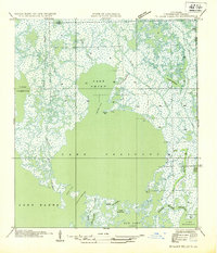
1954 Map of Lake Felicity
USGS Topo · Published 1954About this map
Lake Felicity and the surrounding coastal marsh of Terrebonne Parish are depicted here as a complex network of wetlands and tidal channels prior to the significant land loss of the later 20th century. The map shows the intricate natural drainage system of the Louisiana coast, featuring large open basins like Lake Chien and Lake Barre connected by winding waterways such as Bayou Jean Lacroix and Bayou St Jean Charles.
Find a feature on this map
32 named features on this map. Tap any name to fly to it.
Don’t see what you’re looking for? This feature index may not catch every label — zoom into the map to look around manually.
Map Details
Editions of this 1954 Lake Felicity Map
This is the sole edition of this map. No revisions or reprints were ever made.
Other maps of this area

1894 · Timbalier
USGS Topo · 1:62,500

1894 · Lake Felicity
USGS Topo · 1:62,500

1894 · Dulac
USGS Topo · 1:62,500

1935 · Bourbeux
USGS Topo · 1:31,680

1935 · Viguerie Canal
USGS Topo · 1:31,680

1935 · Montegut
USGS Topo · 1:31,680

1935 · Bay Courant
USGS Topo · 1:31,680

1935 · Golden Meadow
USGS Topo · 1:31,680

1935 · Pelican Pass
USGS Topo · 1:31,680

1939 · Lake Felicity
USGS Topo · 1:62,500