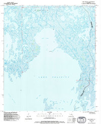
1994 Map of Lake Felicity
USGS Topo · Published 1994About this map
The Bayou Jean Lacroix Oil and Gas Field anchors the northern reaches of this coastal landscape, illustrating the industrial footprint within the Louisiana marshlands during the late twentieth century. This aquatic environment is defined by the expansive waters of Lake Felicity and Lake Chien, which are linked by the Grand Cut. The map details a complex network of waterways, including Bayou Tambour and Bayou Lacroix, which navigate the fragmented wetlands. The eastern boundary is marked by the parish line dividing Terrebonne Parish and Lafourche Parish, cutting through Lake Billiot and following the course of Felic-ity Bayou. To the south, the Fornation Islands sit at the edge of Lake Raccourci, showcasing a landscape where land and water are in constant flux, with features like Old Lady Lake and Lake du Diable highlighting the region's unique nomenclature.
Find a feature on this map
28 named features on this map. Tap any name to fly to it.
Don’t see what you’re looking for? This feature index may not catch every label — zoom into the map to look around manually.
Map Details
Editions of this 1994 Lake Felicity Map
This is the sole edition of this map. No revisions or reprints were ever made.
Other maps of this area

1894 · Timbalier
USGS Topo · 1:62,500

1894 · Lake Felicity
USGS Topo · 1:62,500

1894 · Dulac
USGS Topo · 1:62,500

1935 · Bourbeux
USGS Topo · 1:31,680

1935 · Viguerie Canal
USGS Topo · 1:31,680

1935 · Montegut
USGS Topo · 1:31,680

1935 · Bay Courant
USGS Topo · 1:31,680

1935 · Golden Meadow
USGS Topo · 1:31,680

1935 · Pelican Pass
USGS Topo · 1:31,680

1939 · Lake Felicity
USGS Topo · 1:62,500