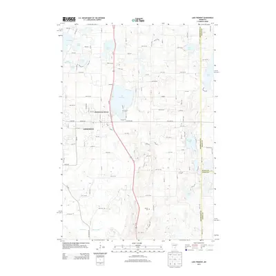
2013 Map of Lake Fremont
USGS Topo · Published 2013About this map
Zimmerman serves as the central hub of this Sherburne County landscape, where the residential grids of Zimmerman Terrace meet the busy corridor of Us-169. The geography is defined by a dense concentration of glacial lakes and wetlands, including the prominent Lake Fremont and Cantlin Lake, which transition into the drainage networks of Battle Brook and Tibbits Brook. Local history is anchored by several burial sites that trace the area's development, such as Saint Pius X Cem, the Livonia Cem located further east, and the Whitney Cem to the south. This 2013 survey illustrates the modern interface between suburban expansion and the region's complex hydrology, showing how local routes like Elk Lake Rd E and 285th Ave navigate the gaps between water bodies like Goose Lake and Blue Lake.
Find a feature on this map
110 named features on this map. Tap any name to fly to it.
Don’t see what you’re looking for? This feature index may not catch every label — zoom into the map to look around manually.
Map Details
Editions of this 2013 Lake Fremont Map
This is the sole edition of this map. No revisions or reprints were ever made.
Other maps of this area

1916 · St. Francis
USGS Topo · 1:62,500

1919 · St. Francis
USGS Topo · 1:62,500

1953 · Stillwater
USGS Topo · 1:250,000

1955 · Stillwater
USGS Topo · 1:250,000

1958 · Stillwater
USGS Topo · 1:250,000

1961 · Big Lake
USGS Topo · 1:24,000

1961 · Orrock
USGS Topo · 1:24,000

1961 · Lake Fremont
USGS Topo · 1:24,000

1961 · Elk River
USGS Topo · 1:24,000

1961 · Wyanett
USGS Topo · 1:24,000