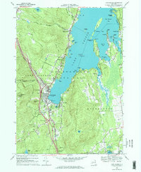
1966 Map of Lake George
USGS Topo · Published 1970About this map
Fort William Henry stands at the southern terminus of the lake, anchoring a landscape that bridges revolutionary-era history with mid-century recreation. This mid-1960s survey documents the burgeoning tourism infrastructure in Lake George, where the Toll Road winds up Prospect Mtn to a Lookout Tower, overlooking the Adirondack Park. The map captures the density of lakeshore life, from the Hearthstone Point State Campsite to the seasonal enclaves of Cleverdale and Rockhurst along the eastern shore. Away from the water, the terrain is marked by commemorative landmarks like the Colonel Williams Monument and a Grave near Bloody Pond, signifying the area's deep-seated colonial history. The development of the Adirondack Northway is visible, signaling a new era of accessibility for the region's camps and public beaches.
Find a feature on this map
72 named features on this map. Tap any name to fly to it.
Don’t see what you’re looking for? This feature index may not catch every label — zoom into the map to look around manually.
Map Details
Editions of this 1966 Lake George Map
3 editions found
Other maps of this area

1895 · North Creek
USGS Topo · 1:62,500

1895 · Glens Falls
USGS Topo · 1:62,500

1897 · Bolton
USGS Topo · 1:62,500

1897 · Glens Falls
USGS Topo · 1:62,500

1897 · North Creek
USGS Topo · 1:62,500

1900 · Bolton
USGS Topo · 1:62,500

1903 · Luzerne
USGS Topo · 1:62,500

1938 · Glens Falls
USGS Topo · 1:62,500

1947 · Glens Falls
USGS Topo · 1:62,500

1950 · Glens Falls
USGS Topo · 1:250,000