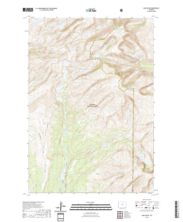
2021 Map of Lake Helen
USGS Topo · Published 2021About this map
Bighorn National Forest contains a complex network of high-altitude waterways and trails along the border of Big Horn and Johnson counties. The landscape is defined by massive formations such as Bomber Mtn and Mather Peaks, with Florence Pass serving as a critical navigation point through the high country. Numerous alpine lakes, including Summit Lake, Lake Marion, and Mirror Lake, feed the various branches of Paint Rock Cr and Middle Tensleep Cr. This survey illustrates the intricate trail systems used by travelers in the early 21st century, such as the Solitude Loop Trl, Misty Moon Trl, and Salinas Trl. The presence of Medicine Park and Medicine Cabin Park suggests established backcountry destinations tucked within Florence Canyon.
Find a feature on this map
42 named features on this map. Tap any name to fly to it.
Don’t see what you’re looking for? This feature index may not catch every label — zoom into the map to look around manually.
Map Details
Editions of this 2021 Lake Helen Map
This is the sole edition of this map. No revisions or reprints were ever made.
Other maps of this area

1899 · Cloud peak
USGS Topo · 1:125,000

1901 · Cloud Peak
USGS Topo · 1:125,000

1955 · Sheridan
USGS Topo · 1:250,000

1958 · Sheridan
USGS Topo · 1:250,000

1960 · Shell Lake
USGS Topo · 1:24,000

1960 · Lake Solitude
USGS Topo · 1:24,000

1962 · Sheridan
USGS Topo · 1:250,000

1967 · Brokenback Narrows
USGS Topo · 1:24,000
1967 · Willow Park Reservoir
USGS Topo · 1:24,000
1967 · Meadowlark Lake
USGS Topo · 1:24,000