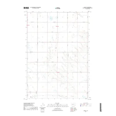
2017 Map of Lake Hill
USGS Topo · Published 2017About this map
The northern edge of Wall occupies the southwestern corner of this West River landscape, where the prairie begins its transition into the drainage systems of the Badlands. The terrain is defined by a series of intermittent watercourses, including the winding path of Cottonwood Cr and the headwaters of Lake Cr and Elm Cr. These seasonal streams carve distinct draws through the high plains, revealing the underlying topography of Pennington County.
Find a feature on this map
32 named features on this map. Tap any name to fly to it.
Don’t see what you’re looking for? This feature index may not catch every label — zoom into the map to look around manually.
Map Details
Editions of this 2017 Lake Hill Map
This is the sole edition of this map. No revisions or reprints were ever made.
Other maps of this area

1953 · Rapid City
USGS Topo · 1:250,000

1954 · Wasta NE
USGS Topo · 1:24,000

1954 · Wasta SE
USGS Topo · 1:24,000

1955 · Hot Springs
USGS Topo · 1:250,000

1957 · Rapid City
USGS Topo · 1:250,000

1960 · Quinn Table NE
USGS Topo · 1:24,000

1960 · Wall
USGS Topo · 1:24,000
1961 · Wall NE
USGS Topo · 1:24,000

1981 · Wall
USGS Topo · 1:100,000
1983 · Horse Tooth
USGS Topo · 1:24,000