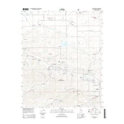
2015 Map of Lake Hughes
USGS Topo · Published 2015About this map
The San Andreas Fault cuts a dramatic diagonal path through this 2015 survey, defining the valley that holds Hughes Lake, Munz Lakes, and Elizabeth Lake. This geological rift serves as the structural anchor for the communities of Lake Hughes and Elizabeth Lake, where residential streets like Lakeview Dr and Joey Ct cluster against the northern edge of the Angeles National Forest. The map also documents the critical water infrastructure of the region, including the Los Angeles Aqueduct and the Second Los Angeles Aqueduct, which channel water toward the Fairmont Reservoir.
Find a feature on this map
86 named features on this map. Tap any name to fly to it.
Don’t see what you’re looking for? This feature index may not catch every label — zoom into the map to look around manually.
Map Details
Editions of this 2015 Lake Hughes Map
This is the sole edition of this map. No revisions or reprints were ever made.
Other maps of this area

1903 · Tejon
USGS Topo · 1:125,000

1915 · Elizabeth Lake
USGS Topo · 1:125,000

1917 · Elizabeth Lake
USGS Topo · 1:125,000

1931 · Warm Spring
USGS Topo · 1:24,000

1931 · Little Buttes
USGS Topo · 1:24,000

1932 · Lake
USGS Topo · 1:24,000

1932 · Hughes Lake
USGS Topo · 1:24,000

1932 · Fairmont
USGS Topo · 1:24,000

1933 · Manzana
USGS Topo · 1:24,000

1934 · Little Buttes
USGS Topo · 1:24,000