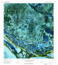
1972 Map of Lake Ingraham East
USGS Topo · Published 1976About this map
Cape Sable and the surrounding coastal wetlands are captured in high detail on this 1972 orthophotomap, which uses aerial photography to depict the complex hydrology of Everglades National Park. The landscape is dominated by the massive Lake Ingraham, which is separated from the Gulf of Mexico by a narrow strip of land. A network of inland waterways, including the Joe River and the engineered Homestead Canal, reveals the movement of water through this low-lying environment.
Find a feature on this map
19 named features on this map. Tap any name to fly to it.
Don’t see what you’re looking for? This feature index may not catch every label — zoom into the map to look around manually.
Map Details
Editions of this 1972 Lake Ingraham East Map
2 editions found
Other maps of this area

1956 · Miami
USGS Topo · 1:250,000

1958 · Miami
USGS Topo · 1:250,000

1972 · Whitewater Bay West
USGS Topo · 1:24,000

1972 · Whitewater Bay East
USGS Topo · 1:24,000

1972 · Lake Ingraham East
USGS Topo · 1:24,000
1972 · Lake Ingraham West
USGS Topo · 1:24,000

1972 · Sandy Key
USGS Topo · 1:24,000

1972 · Clive Key
USGS Topo · 1:24,000

1972 · Shark River Island
USGS Topo · 1:24,000
1973 · Flamingo
USGS Topo · 1:24,000