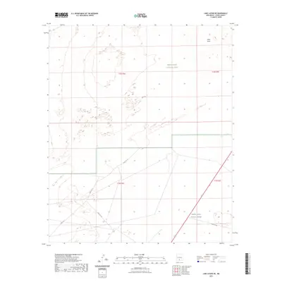
2023 Map of Lake Lucero NE
USGS Topo · Published 2023About this map
White Sands National Park and the adjacent White Sands Missile Range dominate this desert landscape in Otero County. The terrain is characterized by the expansive White Sands gypsum dunes, which shift and flow according to local wind patterns across the Tularosa Basin. This modern survey illustrates the proximity of conservation lands and active military infrastructure, where specialized routes like Wsmr P Rt 21 and Wsmr S Rt 264 cut through the arid basin floor. These corridors support the unique mission of the missile range, established in the mid-20th century, while preserving the natural geography of the neighboring national park.
Find a feature on this map
10 named features on this map. Tap any name to fly to it.
Don’t see what you’re looking for? This feature index may not catch every label — zoom into the map to look around manually.
Map Details
Editions of this 2023 Lake Lucero NE Map
This is the sole edition of this map. No revisions or reprints were ever made.
Other maps of this area

1916 · Point Of Sands
USGS Topo · 1:125,000

1947 · Point Of Sands 2
USGS Topo · 1:62,500

1947 · Lake Lucero
USGS Topo · 1:62,500

1948 · Tres Hermanos
USGS Topo · 1:62,500

1948 · Holloman
USGS Topo · 1:62,500

1948 · Lake Lucero
USGS Topo · 1:24,000

1948 · Lake Lucero SW
USGS Topo · 1:24,000

1948 · Lake Lucero SE
USGS Topo · 1:24,000
1950 · Lake Lucero
USGS Topo · 1:24,000
1950 · Lake Lucero SW
USGS Topo · 1:24,000