
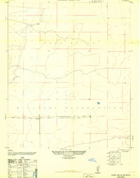
1948 Map of Lake Lucero SW
USGS Topo · Published 1973About this map
San Andres Mountains dominate the western half of this 1948 landscape, where rugged high-desert peaks transition sharply into the basin floor. This area represents a complex overlap of conservation and military history, with the San Andres National Wildlife Refuge protecting the higher elevations of Goat Mountain and Black Mountain while the eastern flats are designated as the White Sands Proving Grounds.
Find a feature on this map
21 named features on this map. Tap any name to fly to it.
Don’t see what you’re looking for? This feature index may not catch every label — zoom into the map to look around manually.
Map Details
Editions of this 1948 Lake Lucero SW Map
This is the sole edition of this map. No revisions or reprints were ever made.
Other maps of this area

1891 · Las Cruces
USGS Topo · 1:125,000

1893 · Las Cruces
USGS Topo · 1:125,000

1916 · Tonuco
USGS Topo · 1:125,000

1916 · Point Of Sands
USGS Topo · 1:125,000

1932 · Tonuco
USGS Topo · 1:125,000

1941 · Organ Peak
USGS Topo · 1:62,500

1943 · Parker Lake
USGS Topo · 1:62,500

1943 · Organ Peak
USGS Topo · 1:62,500

1947 · Lake Lucero
USGS Topo · 1:62,500
1948 · Parker Lake NE
USGS Topo · 1:24,000