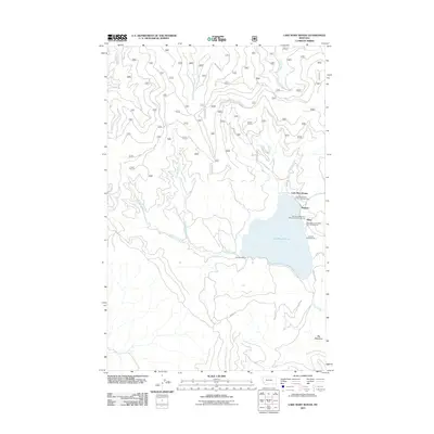
2011 Map of Lake Mary Ronan
USGS Topo · Published 2011About this map
Lake Mary Ronan serves as the central focal point of this western Montana landscape, surrounded by a dense network of recreational sites and creek drainages. Small lakeside communities such as Meltons and Sipes are established on the eastern shore, supported by several organized sites including the Lake Mary Ronan State Park Campground, Lambeth Campground, and Mountain Meadows Resort and Campground. The rugged geography is defined by numerous waterways like Wild Bill Creek, Freeland Creek, and Donaldson Creek that feed into the lake or the southern Ronan Creek drainage.
Find a feature on this map
71 named features on this map. Tap any name to fly to it.
Don’t see what you’re looking for? This feature index may not catch every label — zoom into the map to look around manually.
Map Details
Editions of this 2011 Lake Mary Ronan Map
This is the sole edition of this map. No revisions or reprints were ever made.
Other maps of this area

1920 · Flathead Lake
USGS Topo · 1:125,000

1943 · Kalispell
USGS Topo · 1:125,000

1956 · Wallace
USGS Topo · 1:250,000

1957 · Kalispell
USGS Topo · 1:250,000

1960 · Kalispell
USGS Topo · 1:250,000

1960 · Wallace
USGS Topo · 1:250,000

1961 · Kalispell
USGS Topo · 1:250,000

1962 · Kila
USGS Topo · 1:24,000

1962 · Lion Mountain
USGS Topo · 1:24,000

1964 · Irvine Lookout Tower
USGS Topo · 1:24,000