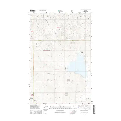
2014 Map of Lake Mary Ronan
USGS Topo · Published 2014About this map
Lake Mary Ronan sits as the central geographic focus of this 2014 survey, surrounded by the high elevations of the Salish Mountains and the Hog Heaven Range. The landscape is a mix of managed public timberlands and small lakeside developments, where road networks like W Shore Rd and Camp Tuffit Rd provide access to seasonal and year-round residences. To the north, the terrain climbs toward Wild Bill Mtn and Blacktail Mtn within the Flathead National Forest, while the southern reaches descend toward the small community of Niarada along Cromwell Creek. Small named locales such as Meltons and Sipes on the eastern shore indicate the area's long-standing draw for recreation and settlement. The map captures the complex interface between the wilderness of the forest and the localized developments on the lake's periphery.
Find a feature on this map
30 named features on this map. Tap any name to fly to it.
Don’t see what you’re looking for? This feature index may not catch every label — zoom into the map to look around manually.
Map Details
Editions of this 2014 Lake Mary Ronan Map
This is the sole edition of this map. No revisions or reprints were ever made.
Other maps of this area

1920 · Flathead Lake
USGS Topo · 1:125,000

1943 · Kalispell
USGS Topo · 1:125,000

1956 · Wallace
USGS Topo · 1:250,000

1957 · Kalispell
USGS Topo · 1:250,000

1960 · Kalispell
USGS Topo · 1:250,000

1960 · Wallace
USGS Topo · 1:250,000

1961 · Kalispell
USGS Topo · 1:250,000

1962 · Kila
USGS Topo · 1:24,000

1962 · Lion Mountain
USGS Topo · 1:24,000

1964 · Irvine Lookout Tower
USGS Topo · 1:24,000