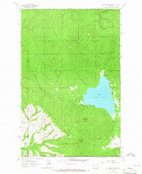
1964 Map of Lake Mary Ronan
USGS Topo · Published 1966About this map
Lake Mary Ronan dominates the eastern portion of this mid-1960s survey, situated along the boundary where the Flathead National Forest meets the northern edge of the Flathead Indian Reservation. The terrain is characterized by the prominent Wild Bill Mountain and Blacktail Mountain to the north, with the Hog Heaven Range rising in the southwest.
Find a feature on this map
21 named features on this map. Tap any name to fly to it.
Don’t see what you’re looking for? This feature index may not catch every label — zoom into the map to look around manually.
Map Details
Editions of this 1964 Lake Mary Ronan Map
This is the sole edition of this map. No revisions or reprints were ever made.
Other maps of this area

1920 · Flathead Lake
USGS Topo · 1:125,000

1943 · Kalispell
USGS Topo · 1:125,000

1956 · Wallace
USGS Topo · 1:250,000

1957 · Kalispell
USGS Topo · 1:250,000

1960 · Kalispell
USGS Topo · 1:250,000

1960 · Wallace
USGS Topo · 1:250,000

1961 · Kalispell
USGS Topo · 1:250,000

1962 · Kila
USGS Topo · 1:24,000

1962 · Lion Mountain
USGS Topo · 1:24,000

1964 · Irvine Lookout Tower
USGS Topo · 1:24,000