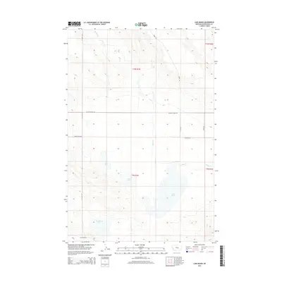
2014 Map of Lake Mason
USGS Topo · Published 2014About this map
Lake Mason and its surrounding wetlands form the center of this Musselshell County landscape, where the prairie hydrology is defined by a series of significant water bodies including Lake Thom, Talbot Lake, and May Martin Lake. The drainage of Willow Cr moves through the terrain, which is structured by the Public Land Survey System into townships T9N and T10N. A sparse network of gravel and local roads, such as Harris Rd and Hochmuth Rd, serves the ranching and agricultural interests of the region. The presence of Grazing District Rd and Timber Buttes Rd highlights the managed nature of this Montana rangeland, while Golf Course Rd at the southern edge suggests proximity to localized recreation in an otherwise low-density area.
Find a feature on this map
16 named features on this map. Tap any name to fly to it.
Don’t see what you’re looking for? This feature index may not catch every label — zoom into the map to look around manually.
Map Details
Editions of this 2014 Lake Mason Map
This is the sole edition of this map. No revisions or reprints were ever made.
Other maps of this area

1954 · Roundup
USGS Topo · 1:250,000

1958 · Roundup
USGS Topo · 1:250,000

1979 · Roundup
USGS Topo · 1:100,000

1979 · Timber Buttes South
USGS Topo · 1:24,000

1979 · Horsethief Creek
USGS Topo · 1:24,000

1979 · Roundup
USGS Topo · 1:24,000

1986 · Lake Mason SE
USGS Topo · 1:24,000

1986 · Pender Coulee
USGS Topo · 1:24,000

1986 · Lake Mason NE
USGS Topo · 1:24,000

1986 · Lake Mason NW
USGS Topo · 1:24,000