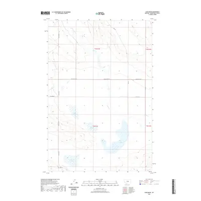
2020 Map of Lake Mason
USGS Topo · Published 2020About this map
Lake Mason and its surrounding wetlands form the centerpiece of this Musselshell County landscape, where the ephemeral waters of Talbot Lake, May Martin Lake, and Lake Thom dot the plains. The terrain is defined by the winding course of Willow Cr and a sparse network of rural routes such as Lake Mason Rd and Grazing District Rd. This modern survey illustrates the expansive reach of the Public Land Survey System, with township and range lines like t10n r24e and t9n r25e dividing the territory. Away from the water bodies, the map shows the transition to managed lands near Golf Course Rd, reflecting the quiet agricultural and recreational character of this high plains region north of Roundup.
Find a feature on this map
16 named features on this map. Tap any name to fly to it.
Don’t see what you’re looking for? This feature index may not catch every label — zoom into the map to look around manually.
Map Details
Editions of this 2020 Lake Mason Map
This is the sole edition of this map. No revisions or reprints were ever made.
Other maps of this area

1954 · Roundup
USGS Topo · 1:250,000

1958 · Roundup
USGS Topo · 1:250,000

1979 · Roundup
USGS Topo · 1:100,000

1979 · Timber Buttes South
USGS Topo · 1:24,000

1979 · Horsethief Creek
USGS Topo · 1:24,000

1979 · Roundup
USGS Topo · 1:24,000

1986 · Lake Mason SE
USGS Topo · 1:24,000

1986 · Pender Coulee
USGS Topo · 1:24,000

1986 · Lake Mason NE
USGS Topo · 1:24,000

1986 · Lake Mason NW
USGS Topo · 1:24,000