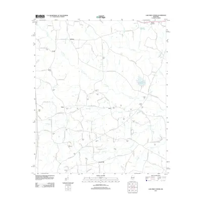
2012 Map of Lake Mike Connor
USGS Topo · Published 2012About this map
Lake Mike Connor serves as a focal point for this rural Jefferson Davis County landscape, where the Boule River and its tributaries like W Bowie Cr and Santee Br drain the timbered terrain. The area is characterized by a dense network of family and community history, evidenced by more than twenty named cemeteries such as Loflin-Applewhite Cem, Saulters-McRaney Cem, and Double Churches Cem. Small settlements like Santee, Deen, and McRaney are linked by local routes such as Three Notch Rd and Santee Methodist Rd. The presence of the Methodist-Protestant Campgrounds and sites like Watsons Mill Pond and Cantwell Mill suggests a long-standing pattern of agricultural and social gathering in this part of Mississippi, centered around the slow-moving waters and creek bottoms.
Find a feature on this map
120 named features on this map. Tap any name to fly to it.
Don’t see what you’re looking for? This feature index may not catch every label — zoom into the map to look around manually.
Map Details
Editions of this 2012 Lake Mike Connor Map
This is the sole edition of this map. No revisions or reprints were ever made.
Other maps of this area

1953 · Hattiesburg
USGS Topo · 1:250,000

1958 · Hattiesburg
USGS Topo · 1:250,000

1970 · Bunker Hill
USGS Topo · 1:24,000

1970 · Prentiss East
USGS Topo · 1:24,000

1970 · Mount Carmel
USGS Topo · 1:24,000

1974 · Lone Star
USGS Topo · 1:24,000

1974 · Sumrall
USGS Topo · 1:24,000

1974 · Williamsburg
USGS Topo · 1:24,000

1974 · Collins
USGS Topo · 1:24,000

1974 · Bassfield
USGS Topo · 1:24,000