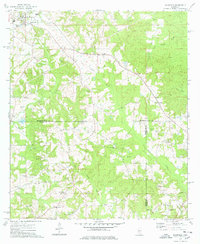
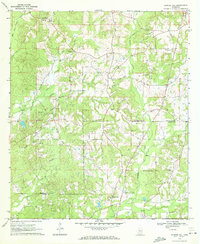
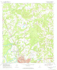
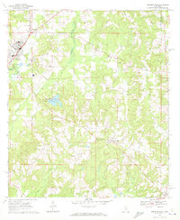
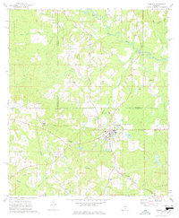
1974 Map of Bassfield
USGS Topo · Published 1978About this map
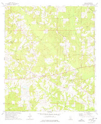
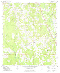
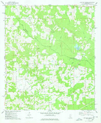
The Illinois Central Gulf railroad cuts a diagonal path across this southern Mississippi landscape, connecting the town of Bassfield to smaller surrounding communities. The terrain is defined by the winding course of Black Creek and its tributaries, including Gum Swamp Creek and Upper Little Creek, which carve through the timbered hills. This survey records a rural society organized around family-named landmarks and local congregations, with several community hubs situated near the county boundaries where Jefferson Davis, Marion, and Lamar counties meet.
Find a feature on this map
32 named features on this map. Tap any name to fly to it.
Don’t see what you’re looking for? This feature index may not catch every label — zoom into the map to look around manually.
Map Details
Editions of this 1974 Bassfield Map
This is the sole edition of this map. No revisions or reprints were ever made.
Other maps of this area

1953 · Hattiesburg
USGS Topo · 1:250,000

1958 · Hattiesburg
USGS Topo · 1:250,000
1970 · Bunker Hill
USGS Topo · 1:24,000
1970 · Columbia North
USGS Topo · 1:24,000
1970 · Prentiss East
USGS Topo · 1:24,000
1974 · Sumrall
USGS Topo · 1:24,000
1974 · Oloh
USGS Topo · 1:24,000
1974 · Williamsburg
USGS Topo · 1:24,000
1974 · Lake Mike Connor
USGS Topo · 1:24,000

1984 · Hattiesburg
USGS Topo · 1:250,000