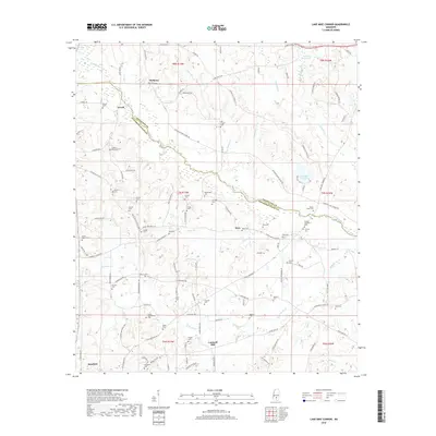
2018 Map of Lake Mike Connor
USGS Topo · Published 2018About this map
Cantwell Mill and the expansive waters of Lake Mike Connor define the rural landscape of Jefferson Davis and Covington Counties. The Bouie River meanders across the territory, joined by numerous tributaries including Santee Br, Colbert Br, and the aptly named Terrible Cr. This region is characterized by a dense distribution of family and community burial grounds, serving as a significant record of local genealogy. From the Loflin-Applewhite Cem in the south to the Old Chapel Cem further north, these sites are interspersed among small settlements like Bassfield, Deen, and Terrell. The map details an established network of country roads, such as Three Notch Rd and Blackjack Rd, which connect these dispersed homesteads and landmarks like Watsons Mill Pond and Sweet Water Cem, reflecting the agricultural and communal foundations of south-central Mississippi.
Find a feature on this map
137 named features on this map. Tap any name to fly to it.
Don’t see what you’re looking for? This feature index may not catch every label — zoom into the map to look around manually.
Map Details
Editions of this 2018 Lake Mike Connor Map
This is the sole edition of this map. No revisions or reprints were ever made.
Other maps of this area

1953 · Hattiesburg
USGS Topo · 1:250,000

1958 · Hattiesburg
USGS Topo · 1:250,000

1970 · Bunker Hill
USGS Topo · 1:24,000

1970 · Prentiss East
USGS Topo · 1:24,000

1970 · Mount Carmel
USGS Topo · 1:24,000

1974 · Lone Star
USGS Topo · 1:24,000

1974 · Sumrall
USGS Topo · 1:24,000

1974 · Williamsburg
USGS Topo · 1:24,000

1974 · Collins
USGS Topo · 1:24,000

1974 · Bassfield
USGS Topo · 1:24,000