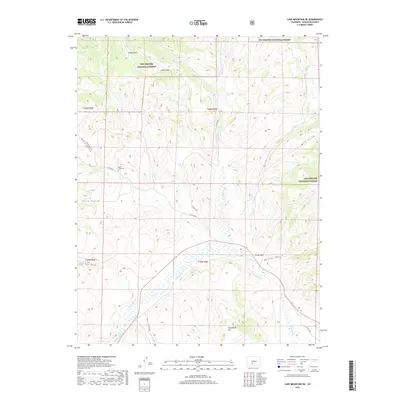
2019 Map of Lake Mountain NE
USGS Topo · Published 2019About this map
Rio Grande National Forest dominates this high-altitude landscape of Saguache County, where a network of gulches and creeks defines the local topography. The drainage pattern is complex, with Saguache Cr and its tributaries like Middle Cr and Ford Cr carving through the terrain near landmarks such as Castle Rock and Houghland Hill. Human presence in this high country is marked by the isolated Jacks Creek Cem and a system of county roads including Co RD 38 Ee. The map illustrates the varied landforms that transitions from open areas like Indian Park to narrow passages such as Mill Gulch and Lone Tree Gulch. This 2019 survey documents the enduring physical character of the Colorado backcountry, showing how modern access roads follow the natural contours established by historic draws and gulches.
Find a feature on this map
28 named features on this map. Tap any name to fly to it.
Don’t see what you’re looking for? This feature index may not catch every label — zoom into the map to look around manually.
Map Details
Editions of this 2019 Lake Mountain NE Map
This is the sole edition of this map. No revisions or reprints were ever made.
Other maps of this area

1956 · Montrose
USGS Topo · 1:250,000

1959 · Montrose
USGS Topo · 1:250,000

1959 · Bonanza
USGS Topo · 1:62,500

1960 · Montrose
USGS Topo · 1:250,000

1967 · Sargents Mesa
USGS Topo · 1:24,000
1967 · Laughlin Gulch
USGS Topo · 1:24,000

1967 · Trickle Mountain
USGS Topo · 1:24,000

1967 · Lake Mountain NE
USGS Topo · 1:24,000
1967 · Lake Mountain NE
USGS Topo · 1:24,000

1967 · Chester
USGS Topo · 1:24,000