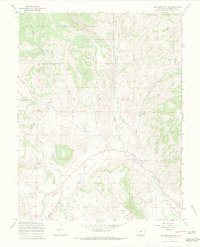
1967 Map of Lake Mountain NE
USGS Topo · Published 1969About this map
Saguache Creek meanders through the southern portion of this landscape, carving a valley between high points like Castle Rock and Houghland Hill. This late-1960s survey, mapped by the U.S. Forest Service, documents a mountainous section of the Rio Grande National Forest characterized by a dense network of watercourses including Middle Creek, Cross Creek, and Bear Creek. Human activity is concentrated along the creek bottoms and lower slopes, where a Gaging Sta monitors the flow of the Saguache and a modern pipeline cuts across the southeastern terrain. Local history and early industry are marked by the presence of the Jacks Creek Cem and a nearby Mine tucked into the drainage of Jacks Creek. The map also captures several primitive routes, including a jeep trail and various trails, which provided access to remote gulches like Ward Gulch and Poison Gulch during this era.
Find a feature on this map
25 named features on this map. Tap any name to fly to it.
Don’t see what you’re looking for? This feature index may not catch every label — zoom into the map to look around manually.
Map Details
Editions of this 1967 Lake Mountain NE Map
4 editions found
Other maps of this area

1914 · Creede
USGS Topo · 1:125,000

1915 · Del Norte
USGS Topo · 1:125,000

1916 · Creede
USGS Topo · 1:125,000

1917 · Del Norte
USGS Topo · 1:125,000

1945 · Durango
USGS Topo · 1:250,000

1953 · Durango
USGS Topo · 1:250,000

1954 · Durango
USGS Topo · 1:250,000

1956 · Montrose
USGS Topo · 1:250,000

1959 · Montrose
USGS Topo · 1:250,000

1960 · Montrose
USGS Topo · 1:250,000