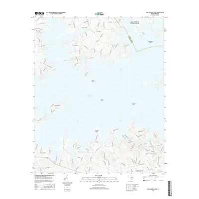
2017 Map of Lake Murray East
USGS Topo · Published 2017About this map
Lake Murray dominates this landscape, its intricate shoreline forming numerous coves and peninsulas that define the northern reaches of Lexington. The map provides a detailed view of the suburban and lakeside development in the late 2010s, showing a dense network of residential roads like Wessinger Rd and Old Lexington Hwy that lead to various landings and points. Notable landforms within the reservoir include Susie Ebert Island, Counts Island, and the Jim Spence Islands, reflecting the complex topography submerged by the Saluda River's impoundment.
Find a feature on this map
117 named features on this map. Tap any name to fly to it.
Don’t see what you’re looking for? This feature index may not catch every label — zoom into the map to look around manually.
Map Details
Editions of this 2017 Lake Murray East Map
This is the sole edition of this map. No revisions or reprints were ever made.
Other maps of this area

1904 · Columbia
USGS Topo · 1:125,000

1941 · Spartanburg
USGS Topo · 1:250,000

1944 · Gilbert
USGS Topo · 1:62,500

1944 · Edmund
USGS Topo · 1:62,500

1946 · Irmo
USGS Topo · 1:24,000

1947 · Richtex
USGS Topo · 1:24,000

1948 · Irmo
USGS Topo · 1:24,000

1949 · Richtex
USGS Topo · 1:24,000

1953 · Spartanburg
USGS Topo · 1:250,000

1954 · Augusta
USGS Topo · 1:250,000