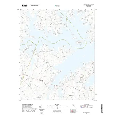
2020 Map of Lake Murray West
USGS Topo · Published 2020About this map
Lake Murray dominates the landscape of this Central South Carolina survey, its complex, branched shoreline creating numerous peninsulas and points like Lominick Point. This part of Lexington County is characterized by a mix of established lakeside communities and rural crossroads that persist into the 21st century. Significant for genealogists and local historians, several family and community burial sites are documented, including Old Lexington Cem, Macedonia Cem, and Hendrix Cem.
Find a feature on this map
141 named features on this map. Tap any name to fly to it.
Don’t see what you’re looking for? This feature index may not catch every label — zoom into the map to look around manually.
Map Details
Editions of this 2020 Lake Murray West Map
This is the sole edition of this map. No revisions or reprints were ever made.
Other maps of this area

1904 · Columbia
USGS Topo · 1:125,000

1941 · Spartanburg
USGS Topo · 1:250,000

1944 · Gilbert
USGS Topo · 1:62,500

1953 · Spartanburg
USGS Topo · 1:250,000

1954 · Augusta
USGS Topo · 1:250,000

1957 · Augusta
USGS Topo · 1:250,000

1958 · Augusta
USGS Topo · 1:250,000

1960 · Spartanburg
USGS Topo · 1:250,000

1961 · Augusta
USGS Topo · 1:250,000

1962 · Augusta
USGS Topo · 1:250,000