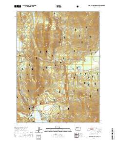
2020 Map of Lake of the Woods North
USGS Topo · Published 2020About this map
Winema National Forest encompasses this high-elevation landscape, where seasonal recreation and water management define the terrain. The northern shores of Lake of the Woods and the tranquil Rainbow Bay serve as a focal point for activity, while the massive Fourmile Lake to the northwest is fed by the Cascade Canal and the Upper Canal. This network of waterways and canals reflects the complex history of resource management in the High Cascades.
Find a feature on this map
61 named features on this map. Tap any name to fly to it.
Don’t see what you’re looking for? This feature index may not catch every label — zoom into the map to look around manually.
Map Details
Editions of this 2020 Lake of the Woods North Map
This is the sole edition of this map. No revisions or reprints were ever made.
Other maps of this area

1891 · Ashland
USGS Topo · 1:250,000

1893 · Ashland
USGS Topo · 1:250,000

1897 · Ashland
USGS Topo · 1:250,000

1955 · Lake O' Woods
USGS Topo · 1:62,500

1955 · Rustler Peak
USGS Topo · 1:62,500

1955 · Mt. Mc Loughlin
USGS Topo · 1:62,500

1955 · Pelican Butte
USGS Topo · 1:62,500

1955 · Medford
USGS Topo · 1:250,000

1957 · Medford
USGS Topo · 1:250,000

1958 · Medford
USGS Topo · 1:250,000