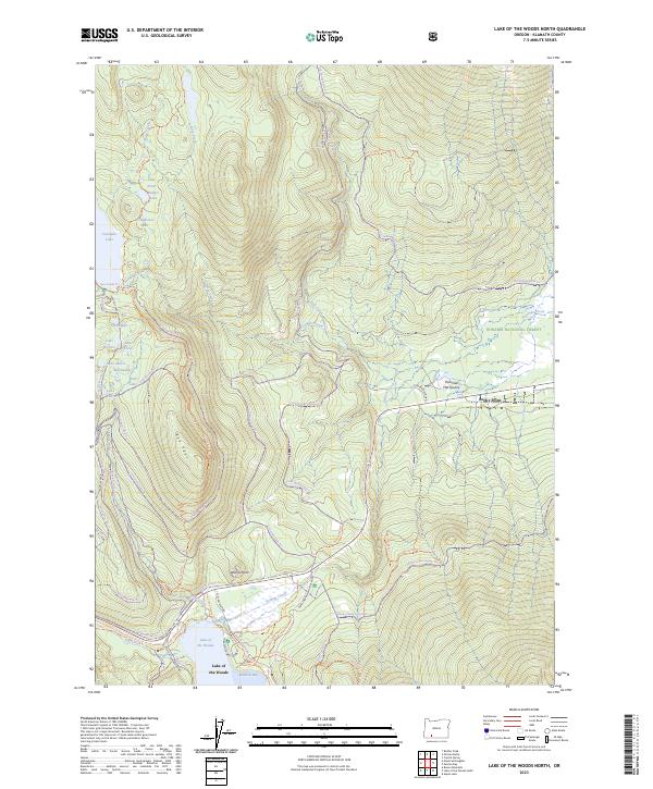
2023 Map of Lake of the Woods North
USGS Topo · Published 2023About this map
Lake of the Woods and the adjacent L.O.W. Recreation Area serve as the central hub for this high-country landscape in the southern Oregon Cascades. The map details an intricate network of specialized transit routes, from the motorized Resort Snomo Trl to the quiet Billie Creek Nature Trl, reflecting the area's modern role as a premier recreational destination. Settlement is concentrated near the lake at Westside Summer Homes, while the surrounding timberlands of the Winema National Forest transition into protected landscapes like the Sky Lakes Wilderness and Mountain Lakes Wilderness. Notable water bodies such as Fourmile Lake and smaller alpine pools like Lake Aphis and Lake Malice are connected by seasonal drainages like Seldom Creek and Billie Creek. Evidence of resource extraction persists at the Fourmile Flat Quarry, situated near the small community of Rocky Point.
Find a feature on this map
68 named features on this map. Tap any name to fly to it.
Don’t see what you’re looking for? This feature index may not catch every label — zoom into the map to look around manually.
Map Details
Editions of this 2023 Lake of the Woods North Map
This is the sole edition of this map. No revisions or reprints were ever made.
Other maps of this area

1891 · Ashland
USGS Topo · 1:250,000

1893 · Ashland
USGS Topo · 1:250,000

1897 · Ashland
USGS Topo · 1:250,000

1955 · Lake O' Woods
USGS Topo · 1:62,500

1955 · Rustler Peak
USGS Topo · 1:62,500

1955 · Mt. Mc Loughlin
USGS Topo · 1:62,500

1955 · Pelican Butte
USGS Topo · 1:62,500

1955 · Medford
USGS Topo · 1:250,000

1957 · Medford
USGS Topo · 1:250,000

1958 · Medford
USGS Topo · 1:250,000