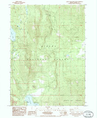
1985 Map of Lake of The Woods North
USGS Topo · Published 1985About this map
Winema National Forest and the Mountain Lakes Wilderness define this high-altitude landscape in the southern Oregon Cascades. The 1985 survey captures a region primarily utilized for recreation and resource extraction, anchored by the significant waters of Fourmile Lake and the northern tip of Lake of The Woods. This area includes the Boy Scout camp at Camp McLoughlin, located along the southern shore near the Lake of the Woods Boat Ramp.
Find a feature on this map
33 named features on this map. Tap any name to fly to it.
Don’t see what you’re looking for? This feature index may not catch every label — zoom into the map to look around manually.
Map Details
Editions of this 1985 Lake of The Woods North Map
This is the sole edition of this map. No revisions or reprints were ever made.
Other maps of this area

1891 · Ashland
USGS Topo · 1:250,000

1893 · Ashland
USGS Topo · 1:250,000

1897 · Ashland
USGS Topo · 1:250,000

1955 · Lake O' Woods
USGS Topo · 1:62,500

1955 · Rustler Peak
USGS Topo · 1:62,500

1955 · Mt. Mc Loughlin
USGS Topo · 1:62,500

1955 · Pelican Butte
USGS Topo · 1:62,500

1955 · Medford
USGS Topo · 1:250,000

1957 · Medford
USGS Topo · 1:250,000

1958 · Medford
USGS Topo · 1:250,000