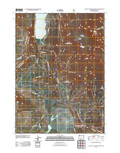
2011 Map of Lake of the Woods South
USGS Topo · Published 2011About this map
Lake of the Woods serves as the focal point for this high-country survey in Klamath County, surrounded by established recreation sites including Sunset Camp, Camp Esther Applegate, and Low Echo Camp. The landscape is defined by a dense network of forest development roads such as Nat For Dev Rd 3750 and Nat For Dev Rd 3850, which facilitate access through the timbered peaks of the Southern Cascades. Numerous watercourses, including Cold Creek and Rainbow Creek, feed the basin, while the topography rises sharply toward prominent summits like Greylock Mountain and Whiteface Peak. To the south, the terrain transitions into the drainage areas of Tunnel Creek and Spencer Creek, where more remote routes like Walters Cabin Rd and Keno Access Rd intersect the hillsides, illustrating the managed wilderness and recreational infrastructure of the early twenty-first century.
Find a feature on this map
33 named features on this map. Tap any name to fly to it.
Don’t see what you’re looking for? This feature index may not catch every label — zoom into the map to look around manually.
Map Details
Editions of this 2011 Lake of the Woods South Map
This is the sole edition of this map. No revisions or reprints were ever made.
Other maps of this area

1891 · Ashland
USGS Topo · 1:250,000

1893 · Ashland
USGS Topo · 1:250,000

1897 · Ashland
USGS Topo · 1:250,000

1955 · Lake O' Woods
USGS Topo · 1:62,500

1955 · Surveyor Mtn
USGS Topo · 1:62,500

1955 · Hyatt Reservoir
USGS Topo · 1:62,500

1955 · Mt. Mc Loughlin
USGS Topo · 1:62,500

1955 · Medford
USGS Topo · 1:250,000

1957 · Medford
USGS Topo · 1:250,000

1958 · Medford
USGS Topo · 1:250,000