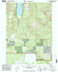
1998 Map of Lake of The Woods South
USGS Topo · Published 2000About this map
Lake Of The Woods and the expansive basin of Buck Lake define this high-altitude landscape on the boundary between the Rogue River and Winema National Forests. In the late 1990s, this area served as a significant recreational and wilderness corridor, featuring the southern reaches of the Mountain Lakes Wilderness. The map captures a transition from the water-oriented activity at Camp Esther Applegate and the northern Boat Ramp to the high volcanic peaks of Brown Mountain and Surveyor Mountain. A complex network of drainage and seasonal hydrology is evident through features like Desolation Swamp and Rainbow Creek, while the presence of the Dead Indian Memorial Road and various levees near Buck Lake illustrate the historical efforts to manage water flow and access through this timber-rich portion of the Cascade Range.
Find a feature on this map
34 named features on this map. Tap any name to fly to it.
Don’t see what you’re looking for? This feature index may not catch every label — zoom into the map to look around manually.
Map Details
Editions of this 1998 Lake of The Woods South Map
This is the sole edition of this map. No revisions or reprints were ever made.
Other maps of this area

1891 · Ashland
USGS Topo · 1:250,000

1893 · Ashland
USGS Topo · 1:250,000

1897 · Ashland
USGS Topo · 1:250,000

1955 · Lake O' Woods
USGS Topo · 1:62,500

1955 · Surveyor Mtn
USGS Topo · 1:62,500

1955 · Hyatt Reservoir
USGS Topo · 1:62,500

1955 · Mt. Mc Loughlin
USGS Topo · 1:62,500

1955 · Medford
USGS Topo · 1:250,000

1957 · Medford
USGS Topo · 1:250,000

1958 · Medford
USGS Topo · 1:250,000