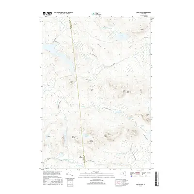
2016 Map of Lake Ozonia
USGS Topo · Published 2016About this map
Lake Ozonia and its surrounding wilderness define this high-elevation landscape along the border of St. Lawrence and Franklin counties. The terrain is characterized by a dense network of water bodies and peaks, including the prominent Azure Mtn and Weller Mtn. Settlement is sparse, with The Meadows providing a rare named location amidst the forest and ponds. A complex hydrological system of outlets and brooks, such as the Lake Ozonia Outlet and Goose Pond Brook, connects isolated waters like Dexter Lake and McCavanaugh Pond. The presence of Miners Hill suggests a history of resource extraction, while named topographical features like Eagle Pass and Arquett Pond Pass indicate the natural corridors used to navigate this section of the Adirondack Park.
Find a feature on this map
53 named features on this map. Tap any name to fly to it.
Don’t see what you’re looking for? This feature index may not catch every label — zoom into the map to look around manually.
Map Details
Editions of this 2016 Lake Ozonia Map
This is the sole edition of this map. No revisions or reprints were ever made.
Other maps of this area

1905 · Saint Regis
USGS Topo · 1:62,500

1919 · Nicholville
USGS Topo · 1:62,500

1920 · Childwold
USGS Topo · 1:62,500

1921 · Childwold
USGS Topo · 1:48,000

1921 · Nicholville
USGS Topo · 1:62,500

1921 · Santa Clara
USGS Topo · 1:62,500

1922 · Childwold
USGS Topo · 1:62,500

1923 · Santa Clara
USGS Topo · 1:62,500

1948 · Ogdensburg
USGS Topo · 1:250,000

1951 · Ogdensburg
USGS Topo · 1:250,000