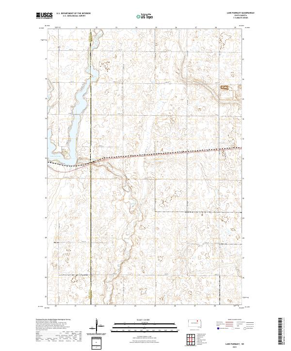
2021 Map of Lake Parmley
USGS Topo · Published 2021About this map
Lake Parmley and the winding course of Snake Creek dominate this corner of the South Dakota prairie along the Edmunds and Brown County line. The landscape is defined by the Jeffersonian grid, with a dense network of section-line roads like 372nd Ave and 131st St providing access to the fertile agricultural lands of the James River Valley. Near the lake’s southern shore, localized development is evident through smaller residential thoroughfares such as Maza Trl, S Shore Dr, and Sunset Dr. This 2021 survey illustrates the modern rural infrastructure of the region, where the natural hydrology of Snake Cr continues to influence the layout of land boundaries and transit routes across Township 123 North.
Find a feature on this map
34 named features on this map. Tap any name to fly to it.
Don’t see what you’re looking for? This feature index may not catch every label — zoom into the map to look around manually.
Map Details
Editions of this 2021 Lake Parmley Map
This is the sole edition of this map. No revisions or reprints were ever made.
Other maps of this area

1899 · Ellendale
USGS Topo · 1:125,000

1899 · Northville
USGS Topo · 1:125,000

1954 · Aberdeen
USGS Topo · 1:250,000

1956 · Aberdeen
USGS Topo · 1:250,000

1960 · Aberdeen West
USGS Topo · 1:24,000

1960 · Rudolph
USGS Topo · 1:24,000

1970 · Lake Parmley
USGS Topo · 1:24,000
1970 · Richmond
USGS Topo · 1:24,000
1970 · Lake Parmley SW
USGS Topo · 1:24,000

1970 · Wetonka South
USGS Topo · 1:24,000