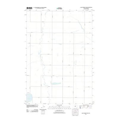
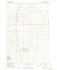
2012 Map of Lake Parmley SW
USGS Topo · Published 2012About this map
North Scatterwood Lake anchors the southwestern corner of this landscape in Highland Township, defining a region characterized by its glacial prairie potholes and drainage patterns. The 2012 survey by the U.S. Geological Survey reveals a strictly organized section-line road network, where routes like 375th Ave and 143rd St bisect the open plains. A notable hydrological feature is Salt Lake, situated centrally among the agricultural plots, illustrating the intermittent water bodies common to this part of Brown County. The placement of Co Rd-26 and various numbered avenues suggests a rural infrastructure built for heavy agricultural transport, connecting isolated farmsteads across the wide, flat topography of the Dakotas.
Find a feature on this map
18 named features on this map. Tap any name to fly to it.
Don’t see what you’re looking for? This feature index may not catch every label — zoom into the map to look around manually.
Map Details
Editions of this 2012 Lake Parmley SW Map
This is the sole edition of this map. No revisions or reprints were ever made.
Other maps of this area

1899 · Northville
USGS Topo · 1:125,000

1954 · Aberdeen
USGS Topo · 1:250,000

1956 · Aberdeen
USGS Topo · 1:250,000

1960 · Aberdeen West
USGS Topo · 1:24,000

1960 · Rudolph
USGS Topo · 1:24,000
1960 · Northville
USGS Topo · 1:24,000
1966 · Chelsea
USGS Topo · 1:24,000
1966 · Cresbard NE
USGS Topo · 1:24,000

1970 · Lake Parmley
USGS Topo · 1:24,000
1970 · Lake Parmley SW
USGS Topo · 1:24,000