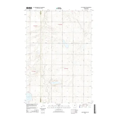
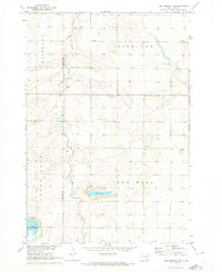
2015 Map of Lake Parmley SW
USGS Topo · Published 2015About this map
The prairie landscape along the border of Edmunds and Brown Counties is defined by its dramatic glacial depression lakes and a strict section-line grid of rural corridors. Salt Lake sits at the heart of this terrain, surrounded by a network of gravel and section-line roads like 375th Ave and 146th St. To the southwest, the larger basin of North Scatterwood Lake reaches into the corner of the map, illustrating the hydrologic character of the James River Valley region. This map records the modern township organization, where older county thoroughfares like Co Road 26 and Co Road 23 provide the primary access to the scattered farmsteads and agricultural plots of Highland Township.
Find a feature on this map
24 named features on this map. Tap any name to fly to it.
Don’t see what you’re looking for? This feature index may not catch every label — zoom into the map to look around manually.
Map Details
Editions of this 2015 Lake Parmley SW Map
This is the sole edition of this map. No revisions or reprints were ever made.
Other maps of this area

1899 · Northville
USGS Topo · 1:125,000

1954 · Aberdeen
USGS Topo · 1:250,000

1956 · Aberdeen
USGS Topo · 1:250,000

1960 · Aberdeen West
USGS Topo · 1:24,000

1960 · Rudolph
USGS Topo · 1:24,000
1960 · Northville
USGS Topo · 1:24,000
1966 · Chelsea
USGS Topo · 1:24,000
1966 · Cresbard NE
USGS Topo · 1:24,000

1970 · Lake Parmley
USGS Topo · 1:24,000
1970 · Lake Parmley SW
USGS Topo · 1:24,000