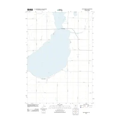
2012 Map of Lake Poinsett
USGS Topo · Published 2012About this map
Lake Poinsett dominates this part of eastern South Dakota, where the landscape is defined by the expansive water and the developed shoreline that encircles it. The map illustrates a transitional period of rural recreation and residence, notably at the settlement of Arlington Beach on the southern shore. A grid of section roads, including 455th Ave and 197th St, provides access to the surrounding agricultural prairie, while more specialized routes like W Lake Dr and E Lake Dr hug the waterline. To the north, the terrain feature known as Stone Bridge marks a critical narrowing between water bodies, serving as a landmark in a region where the interplay of land and water has long dictated local transportation and settlement patterns.
Find a feature on this map
21 named features on this map. Tap any name to fly to it.
Don’t see what you’re looking for? This feature index may not catch every label — zoom into the map to look around manually.
Map Details
Editions of this 2012 Lake Poinsett Map
This is the sole edition of this map. No revisions or reprints were ever made.
Other maps of this area

1953 · Watertown
USGS Topo · 1:250,000

1958 · Watertown
USGS Topo · 1:250,000

1968 · Bruce
USGS Topo · 1:24,000

1968 · Arlington NE
USGS Topo · 1:24,000

1968 · Badger
USGS Topo · 1:24,000

1969 · Hayti
USGS Topo · 1:24,000

1969 · Dempster
USGS Topo · 1:24,000

1969 · Castlewood
USGS Topo · 1:24,000

1969 · Lake Norden
USGS Topo · 1:24,000

1969 · Lake Poinsett
USGS Topo · 1:24,000